 AN INFINITE HISTORY
THE STORY OF A FAMILY IN FRANCE OVER THREE CENTURIES
AN INFINITE HISTORY
A Map of Angoulême in 1791 |
Angoulême in 1791 and 2021 |
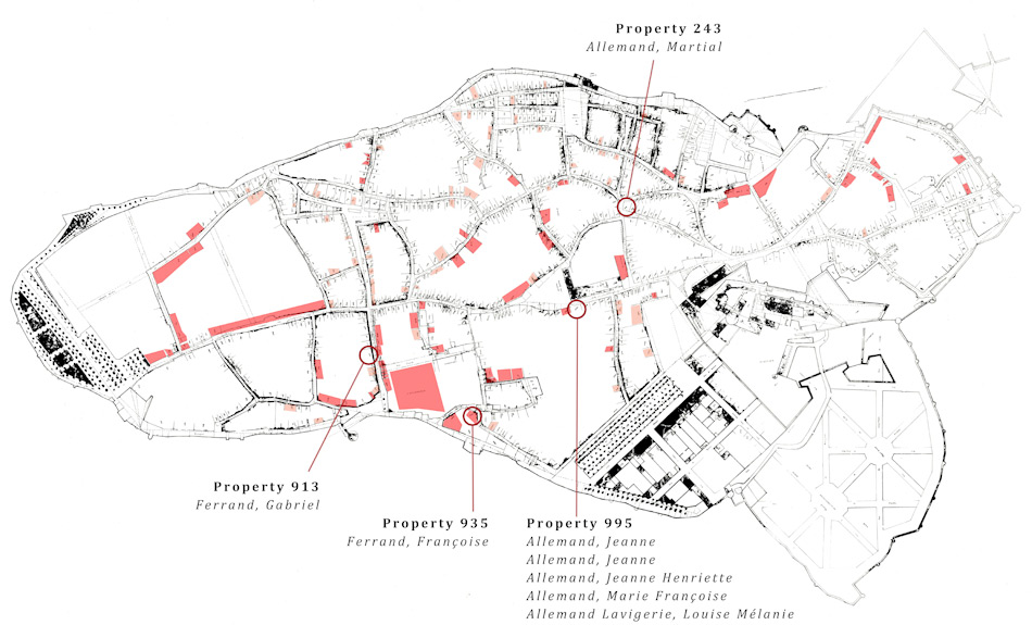
This map is based on the Plan Directeur of Angoulême in 1791, which hangs on the wall of the Archives municipales d'Angoulême. The numbers on the plan correspond to the numbers of the properties listed in the revolutionary register « Contributions, matrices foncières, » also in the Archives municipales. The properties that were owned by religious institutions at the beginning of the revolutionary period are here indicated in red; the properties that are marked in the register as having been acquired in the revolutionary period are indicated in pink.
Two of Marie Aymard’s children and several of her grandchildren appear in the register, and the properties in which they lived are indicated on the map.